In a straight line, it is about 225 nautical miles southeast from Georgetown in the Exumas to Providenciales in the Turks and Caicos Islands. But since the wind blows from the southeast, it is not a straight line, and therefore many more miles.
These are the remote out islands of the southern Bahamas. They are largely unpopulated, and few sailors linger here. To get to the Turks and Caicos, a sailboat must devise a zig zag route from island to island, using the available wind and considering tides and available daylight. The islands are separated by 20 to 50 miles of deep open water. Each leg is a serious passage, with no place to hide along the way. After lazing around the Exumas for more than a month, this was a challenge for us.
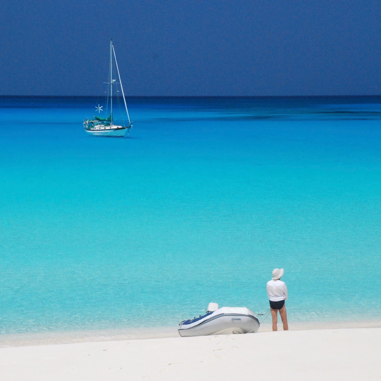
We left Georgetown and Elizabeth Harbor at daybreak on Good Friday headed northeast. La Peregrina was on a close reach and moving fast. We sailed past our planned anchorage on Long Island, and arrived instead at Conception Island before cocktail hour.
Conception Island is a very special place. A Bahamian national park, it is uninhabited, completely undeveloped, and pristine. It has amazing water colors, even by Bahamian standards. The beach has the finest, softest sand I've ever encountered - like talcum powder. We found an amazing petroglyph on a high rock overlooking the sea. We saw nesting white-tailed tropicbirds and brown boobies. We took the dinghy up a tidal creek full of sea turtles. On Easter Sunday, we built a fire on the beach as the sun set. It was a moonless night, and while walking the beach under the stars, we kicked up thousands of tiny lights! Bioluminescence in the sand! Pixie dust! Who knew such a thing existed?
 |
| My girls at Conception Island |
From Conception, we had a pleasant day sail south to Rum Cay. But the islands were farther apart after that. To have daylight both for leaving and entering anchorages, our sails became overnight passages. It took four overnight sails spaced over six days to get from Rum Cay to Providenciales.
On one of those overnights, I made a terrible mistake. La Peregrina arrived just north of our planned anchorage at dawn in 25+ knots of wind. I turned the key to start the motor, but nothing happened. I was annoyed, but not terribly concerned. Our chart book indicated a straightforward entrance to the anchorage from the north. We decided we'd sail in without motor, drop anchor, get some sleep, and then figure out our starter problem.
We were under reefed main and reefed jib as we approached the bank from the deep water, but we came in at more than 6 kts, with big winds and big waves. It was light now, but the sky and the sea was grey. Suddenly, we were in 20 ft of water, then 10, with poor light to see the bottom. We furled in most of the jib, and Maribeth was at the mast, ready to drop the mainsail. Without warning, there were breaking waves dead ahead of us! Reefs all around! MB shouted, “Tack. Let's get out of here." But there was not enough sail up, and not enough time. I turned hard to windward, trying to stall the boat, but there was nothing to do at this point but hope the reef was deep enough. It was not. We hit hard, and spun sideways. The boat made a terrible grinding noise, lifted high up, then leaned grotesquely. Oh my God, we're shipwrecked. So this is how our trip will end.
Suddenly we were moving again. A wave had picked us up and carried us off the reef. We somehow managed to steer around a few more monster coral heads before finally finding a sandy spot to drop the anchor. We were hobby horsing in 3 foot waves, but we were not taking on water and we had no apparent damage. Soon, I found and repaired a loose starter wire, and got the motor running. I had made a huge blunder, but had been given a pass.
In hindsight, it was foolish to enter an unfamiliar anchorage without a motor, without good light to see the reefs, and in heavy weather. I should have hove to and fixed the starter, and had a "Plan B" anchorage lined up. I learned, again, that you can't trust the charts or your chart plotter. Trust only your own eyes!
* * * * * * * * * *
Providenciales, more often called "Provo" by the locals, is a British possession, though their currency is the American dollar. It is a significant stop for a couple of reasons. First of all, with a population of 30,000, it is far bigger than any town we’ve visited since we left the U.S. Maribeth did major provisioning for the first time in more than two months. I gave La Peregrina some overdue attention. We docked three nights at Caicos Marine, and I even hired a diesel mechanic who did in three hours what I would have spent a week figuring out. Together with the crew from another boat, we rented a car and explored the island.
Second, Provo is Important because it is where we had to decide which direction we go in the coming months. Though most boats we've met are heading to the eastern Caribbean, we have decided to turn south and west through the Windward Passage with the goal of reaching Rio Dulce or Panama by the start of hurricane season. This means we'll finally have the wind behind us, and it means we'll need to practice our Spanish. Yesterday, with La Peregrina busting at the seams with food and supplies, we left Provo and sailed overnight to Great Inagua, where we will rest up before heading south again.
There will be opportunities to join us in the next 2 or 3 months. We'd love to share our little adventure with you!
Joe
p.s. Molly helped us set up an Instagram account. Check us out at SailLaPeregrina.
No comments:
Post a Comment